
Public Tree Map
Project Overview
Status:
Completed
Partner: City of Santa Monica
Location: Remote
Links: GitHub, Test Site, Slack, Readme
Tools: Zeplin
Languages:
Technologies: GeoPandas, jQuery, Leaflet, Node.js
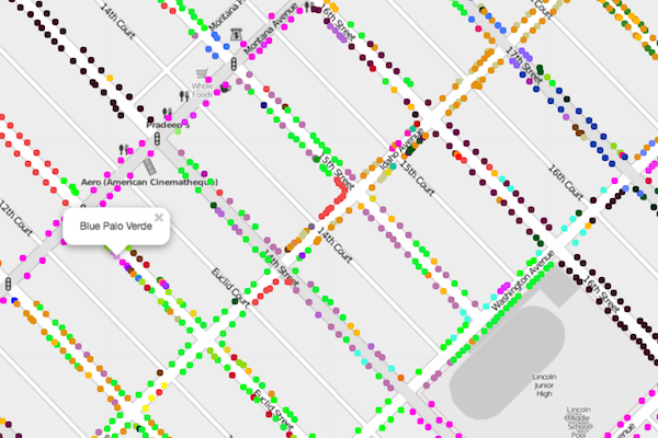
Public Tree Map helps connect people to Santa Monica's urban forest. The map includes information about each of the 35,000 trees (and vacant tree sites) in Santa Monica's publicly-owned urban forest (compiled from open datasets, digitized city records, and federal ecosystem services values), as well as tools for users to share favorite trees. To reflect tree plantings and removals, the map updates every day.
If you would like to talk to us about this completed project, please reach out to [email protected]
Resources
Project Team

Name: Emily F.
Role: Product Owner

Name: Isabelle Wagenvoord
Role: Frontend Lead

Name: Mark Jackson
Role: Backend Developer